This site contains product affiliate links. If you make a purchase after clicking on one of these links, we may receive a commission.
Top 12 Rails-To-Trails Bike Rides Around Pittsburgh
Pittsburgh is home to some of the top rails-to-trails bike rides in Pennsylvania, offering a mix of scenic landscapes, smooth pathways, and a touch of history. As a native Pittsburgher who has spent countless hours on these trails, I’ve come to appreciate their beauty and how each trail offers a unique experience tailored to different types of riders. Whether you’re a casual weekend rider or someone who logs serious miles every week, the region has something to offer you.
From the bustling city routes that showcase Pittsburgh’s skyline to the more secluded paths winding through forests and along rivers, these trails cater to a wide range of preferences. I fall somewhere in the middle, riding four to five times a week, blending fitness with a love for exploring these trails year-round. If you’re planning a visit or just looking to expand your regular biking routine, these Pittsburgh area rails-to-trails bike trails are absolutely worth checking out.
In this guide, I’ll share insights from years of experience riding these trails, highlighting what makes each one special. From local favorites like the North Shore section of the Heritage Trail to hidden gems like the Armstrong Trail, these routes are a must-ride for anyone looking to experience the best that Western Pennsylvania’s rail trails have to offer.

Top 10 Rails-to-Trails Rides In and Around the Pittsburgh Region
Three Rivers Heritage Trail
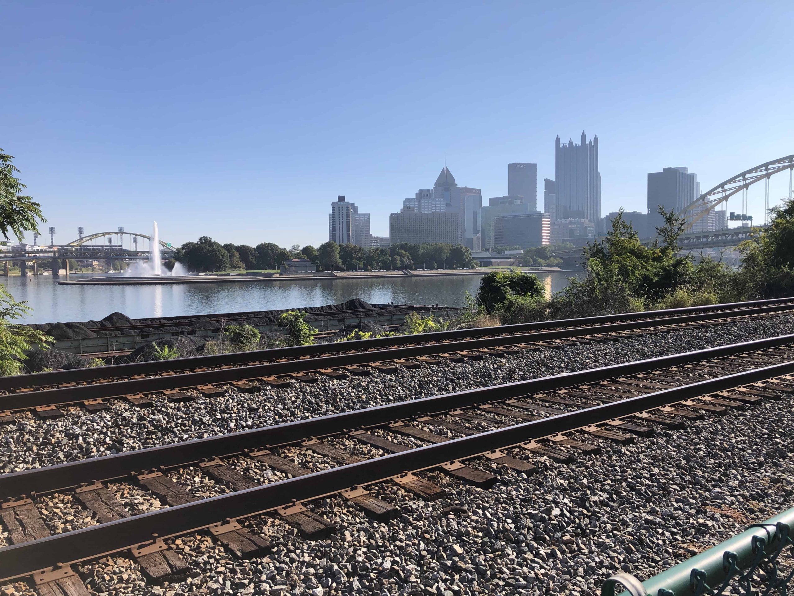
The Three Rivers Heritage Trail is a must-ride bike trail for anyone exploring the top City of Pittsburgh area rails-to-trails bike rides, especially if you’re looking for a convenient daily route with a mix of urban scenery. As a local who bikes the North Shore River Trail section almost daily, I know every inch of this trail.
The trail stretches from Millvale, a small industrial town just outside the city, to the old State Prison near the Ohio River. Along the way, it hugs the Allegheny River, offering smooth paths with stunning views of Pittsburgh’s skyline and easy access to popular spots like Acrisure Stadium and PNC Park.
If you’re in the mood for a longer ride, you can easily extend the trip by crossing the Fort Duquesne Bridge from the North Side and looping through Point State Park. From there, you can seamlessly connect to the Eliza Furnace section—known locally as the “Jail Trail”—which runs east from downtown Pittsburgh. For those planning a bigger adventure, this is also where the Great Allegheny Passage (GAP) Trail begins, eventually leading to Cumberland, Maryland.
Key Details:
- Distance: The North Shore section is approximately 6 miles one way, but extensions can take you much further.
- Highlights: Great city views, accessible trailheads, and connections to urban areas, and longer trail routes. Remember that this section can get busy and noisy, especially on weekends or game days.
- Surface: Paved
- Best Trailhead(s): Start in Millvale for the North Shore section, or opt for the Eliza Furnace trailhead along 2nd Avenue.

Butler-Freeport Trail
The Butler-Freeport Trail ranks among the most scenic and enjoyable rides in the Pittsburgh area for those looking to escape the city and immerse themselves in countryside views. This trail offers a peaceful retreat, with a well-maintained path that winds through picturesque woodlands and follows the gentle flow of Buffalo Creek. It’s perfect for a relaxed ride without the hustle and bustle that busier urban trails often bring.
Spanning nearly 21 miles one way, the trail presents a steady uphill climb if you start in Freeport, followed by a more effortless downhill ride as you approach Butler. The elevation gain is subtle but can sneak up on you, but remember, it makes the return trip feel like a downhill coast. Along the way, you’ll find the Derailleur Bike Shop Café at Dittmer Road—a favorite pit stop for riders. Whether you’re in the mood for a quick snack, an ice cream treat, or a refreshing drink, it can be a welcome stop on your ride.
Key Details:
- Distance: Approximately 21 miles one way.
- Highlights: This trail offers some of the most scenic countryside views in the region. Be prepared for weekend crowds and occasional road crossings. The gradual uphill grade, while manageable, can be deceptive for those unfamiliar with the route.
- Surface: Crushed limestone, with a small paved section near Freeport.
- Best Trailhead(s): The parking lots in Freeport and Butler are the most convenient, with several additional access points along the route.
Armstrong Trail
For those up for a bit more distance from Pittsburgh, the Armstrong Trail is a hidden gem. It’s my go-to ride outside the city, offering a quiet path alongside the Allegheny River. This trail provides a peaceful ride with scenic river views, making it a great option if you want to avoid the crowds found on more popular routes.
One unique aspect of the Armstrong Trail is the series of “camps” along the riverbanks. These small homes and trailers are summer retreats for local families, adding a lively community feel even on quieter sections of the trail. While the path itself stays uncrowded, the nearby river is often buzzing with boaters and activity, blending solitude with glimpses of Western PA’s outdoor lifestyle.
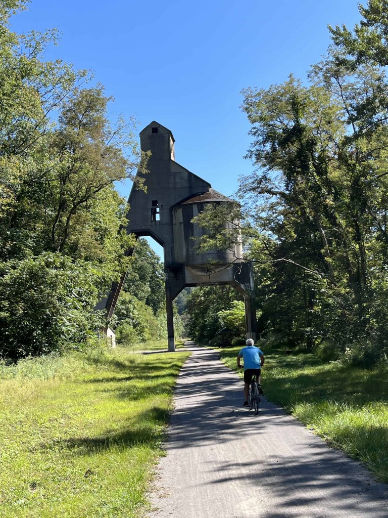
History buffs will also find plenty to enjoy, with sites like the Monticello Iron Furnace, Redbank Coaling Tower, and the Brady Tunnel along the route. The tunnel is currently being refurbished and should reopen soon, making this trail even more appealing.
Key Details:
- Distance: 52 miles one way.
- Highlights: This scenic route follows the Allegheny River through wooded areas and connects with the Redbank Trail, another local favorite.
- Surface: Crushed limestone.
- Best Trailhead(s): Kittanning offers convenient parking and is a great starting point for heading north.
Allegheny River Trail
Another standout is the Allegheny River Trail, particularly if you’re a fan of tunnels. The old railroad tunnels are long enough to require a bike light, creating a thrilling experience as you ride through them. With the Allegheny River running nearby, this trail combines adventure with scenic views, making it a popular destination for serious cyclists.
Add on the Samuel Justus trail branch for a longer ride, which starts in Oil City. Be sure to stop in the town of Franklin, where you will find several great places to lunch. Both trails are built on the old Allegheny Valley Railroad line.
Key Details:
- Distance: The total distance of the trail is 30 miles one way from Franklin to Emlenton.
- Highlights: This great trail follows the northern section of the Allegheny River. Offering great views of the river. The tunnels are a highlight of this ride.
- Surface: The trail is paved, except for a 1-mile section near the town of the trail near Sunny Slopes community, just before you reach the Kennerdell Tunnel heading southbound.
- Best Trailhead(s): Parking in Franklin and riding south is the most accessible.
Redbank Valley Trail
The Redbank Valley Trail should be on your list of top rails-to-trails bike rides around Pittsburgh if you want peace and quiet. This trail isn’t as crowded as others in the region, giving you plenty of space to enjoy the ride. The path winds through dense forests and runs alongside Redbank Creek, providing a calming atmosphere perfect for those who want to escape into nature for a while and enjoy the natural beauty of Western Pennsylvania.
No matter what time of year you ride this trail, it is spectacular. Spring and Summer bring flowers and mountain laurel; this ride’s fall leaves are incredible. Keep an eye out for the various sculptures along the ride.
If you are up for a challenge, check out the Sligo Spur, a 9-mile climb that runs perpendicular to the Redbank Valley Trail near the 6-mile marker.
Key Details:
- Distance: The total distance of the trail is 51 miles one way from Redbank to Brookville.
- Highlights: Offering beautiful scenery and a relatively flat trail that follows Redbank Creek. Two tunnels are located along the trail, so a headlight or flashlight is needed.
- Surface: The trail is crushed limestone and well-maintained.
- Best Trailhead(s): Parking in Redbank along the Armstrong Trail or New Bethlehem is the best spot to pick up the trail.

Sandy Creek Trail
The Sandy Creek Trail is a lesser-known but worthwhile route for riders seeking a quiet experience. It runs through wooded areas and features a standout bridge crossing the Allegheny River. Though shorter, the trail’s peaceful setting makes it ideal for a more relaxed ride.
One of the main features of this trail is its series of repurposed railroad bridges. The crossing over the Allegheny River is particularly notable, with stairs leading down to connect with the Allegheny River Trail for those looking to extend their ride. The paved surface ensures a smooth journey through the region’s remote and scenic parts.
Key Details:
- Distance: 12 miles one way.
- Highlights: Several railroad bridges, including a notable crossing over the Allegheny River with access to the Allegheny River Trail.
- Surface: Paved.
- Best Trailhead(s): Fisherman’s Cove Road, with additional parking available at the halfway point in Belmar.

Ghost Town Trail
The Ghost Town Trail is another regional favorite, with its rolling hills and rich history. The trail passes through several former mining towns, giving you a sense of the area’s industrial past. With a mix of paved and gravel sections, it’s an engaging ride for cyclists who like a bit of variety in their trail surfaces.
The trail’s name comes from the string of long abandoned coal mining towns along the Ebensburgh & Black Lick Railroad. The main section runs from the small towns of Black Lick to Ebensburg, traversing Indiana and Cambria County. When riding from Black Lick, the trail starts with a gradual uphill climb.
This trail easily connects with the Hoodlebug Trail, which winds its way through Indiana County. However, this section of the trail mainly follows a busy road, so it’s not the best ride compared to the Ghost Town Trail.
Key Details:
- Distance: The total distance of the trail is 51 miles one way.
- Highlights: The trail is very scenic and a nice, gentle ride without too many hills or climbs.
- Surface: Crushed Stone
- Best Trailhead(s): Parking at Fisherman’s Cove Road is the best place to start. An additional lot is available at the halfway point in Belmar.
Panhandle and Montour Trails
The Panhandle and Montour Trails offer longer routes for those looking to cover more miles. The Panhandle Trail stretches from Pittsburgh’s suburbs into West Virginia, while the Montour Trail loops around the city’s southern outskirts. Both trails are well-maintained and provide excellent rides through Western Pennsylvania’s hills and suburbs.
I have a personal preference for the Panhandle Trail, which I ride several times a month. Starting in McDonald, PA, the trail transitions from crushed limestone to asphalt as you cross the Washington County line. From there, it’s paved all the way to West Virginia and has a smooth surface. The ride westward features a gradual incline, peaking around Burgettstown before a downhill stretch into the West Virginia state line.
The Montour Trail multi-use trail is a favorite among local bikers, runners, and walkers. It forms a semi-circle around the Greater Pittsburgh area and is one of the country’s longest suburban rail trails. The trail has plenty to offer with its bridges, tunnels, and scenic landscapes. I recently revisited the section from Enlow to Southview and found it an excellent route. Parking in Enlow is convenient, and you can end your ride at Altered Genius Brewery for a post-ride drink and meal.
The Montour Trail has several branch trails, including a connection to the Panhandle Trail and another that leads directly to Pittsburgh International Airport.
Key Details:
- Distance: The Montour Trail spans nearly 56 miles, while the Panhandle Trail covers almost 30 miles.
- Highlights: The Panhandle offers a more remote and scenic experience, especially near the West Virginia section.
- Surface: The Montour Trail is mainly crushed limestone, while the Panhandle Trail is mostly paved.
- Best Trailheads: For the Montour Trail, the Montour Run Road parking area near Robinson Town Center is ideal for those coming from downtown. For the Panhandle Trail, McDonald, PA, is the best starting point, though Oakdale offers good parking options near restaurants and cafes for a post-ride stop.
Great Allegheny Passage (GAP) Trail
No mention of Pittsburgh’s rails-to-trails network is complete without highlighting the Great Allegheny Passage Trail (GAP). While the entire trail spans over 150 miles from Pittsburgh to Cumberland, Maryland, and crosses the Eastern Continental Divide, you can easily tackle shorter sections closer to home. The South Side Trail and Steel Valley Trail are popular choices for those who want a taste of the GAP without committing to the whole adventure. Both sections provide flat, smooth paths that are perfect for beginners or casual weekend rides.
The South Side Trail and Steel Valley Trail make up the portion of the GAP Trail that runs from Pittsburgh’s Station Square to McKeesport. It’s a very popular ride along the Monongahela River, passing some of Pittsburgh’s famed steel mills from past and present.
If you plan to do the entire trail, several outfitters will help you with the logistical aspects of a long ride and shuttle service. This trail can be extended to the nation’s capital, Washington, D.C., via the C&O Canal towpath, making for a total of 334 miles.
Key Details:
- Distance: The total distance of the trail is 150 miles one way, and the section to McKeesport is approximately 13 miles each way.
- Highlights: Undoubtedly one of the most iconic rides in the country. But it does not need to be done in one ride; you can pick off sections, such as the Steel Valley section, on an easy day ride.
- Surface: Various surfaces. The Southside Trail and Steel Valley Trail are paved.
- Best Trailhead(s): You will find various free lots around the city, but my favorite starting point for this ride is the parking lot near the county jail on Second Avenue; it’s free on the weekend.


Oil Creek Trail
If history is your thing, check out the Oil Creek Trail. Located in Oil Creek State Park, this trail runs through the birthplace of the oil industry. The path takes you through scenic valleys and past historic oil wells, offering both a peaceful ride and a glimpse into the area’s industrial roots.
Following the creek makes for a very scenic ride, which is excellent in the fall. You can visit the Drake Well Museum and explore the various exhibits on the first commercial oil well in the U.S.
Key Details:
- Distance: Total distance is 9.5 miles one-way.
- Highlights: Although a very scenic ride, the Drake Well Museum is a highlight of the ride. As you approach the museum, you will hear the pops of the old oil well in the distance.
- Surface: Paved
- Best Trailhead(s): I suggest parking at the Petroleum Center trailhead and riding to the Drake Well.
Lower Trail
The Lower Trail runs from Alexandria to Williamsburg, PA, an often overlooked trail about two hours from Pittsburgh. This remote and wooded path follows the Juniata River, offering a peaceful, relaxing ride. The trail’s seclusion is part of its appeal, providing a quiet escape from busier routes. It’s also a rider-friendly trail with plenty of benches and spots to take a break.
The relatively flat crushed limestone surface makes it an easy ride suitable for most cyclists. Despite flying under the radar, it’s a trail worth the drive for those seeking a scenic, low-key biking experience. It should be added to you top rails-to-trails bike rides around Pittsburgh for sure!
Key Details:
- Distance: 17 miles one-way.
- Highlights: A smooth, scenic ride along the Juniata River with minimal elevation change.
- Surface: Crushed limestone.
- Best Trailhead(s): The parking area near Ganister along Lower Piney Creek Road offers the most convenient access from Pittsburgh.

Looking for a new challenge? Check out the Pine Creek Rail Trail.


Honorable Mention: Pine Creek Rail Trail
Although this trail is outside the immediate Pittsburgh region, the Pine Creek Rail Trail is one of the best rides in Pennsylvania. The 62-mile trail travels through what is known as the Pennsylvania Grand Canyon. For any rails-to-trails enthusiast, this is a must-do ride. Check out this post to learn more about riding the Pine Creek Trail.

Here is a list of trails in the Pittsburgh area with great rides, beer and food along them.
Ride the Rails-To-Trails Around Pittsburgh
The Pittsburgh region offers a wide range of top rails-to-trails bike rides, each with its distinct character. Whether you’re riding the busy Heritage Trail daily or exploring quieter paths like the Lower Trail, there’s something here for every cyclist. From urban routes with skyline views to serene countryside tracks, Western Pennsylvania is a biking haven waiting to be discovered.
Travel Resources
The links above contain product affiliate links.
We may receive a commission at no additional cost to you
if you make a purchase after clicking on one of these links.
But your support of Fork & Wander is greatly appreciated!